Browse Similar Items
THE TOPOGRAPHY OF TROY, AND ITS VICINITY.
(London: Printed by C. Whittingham for T. N. Longman and O. Rees, 1804). 440 x 275 mm. (17 3/8 x 10 7/8"). 2 p.l., 124 pp.
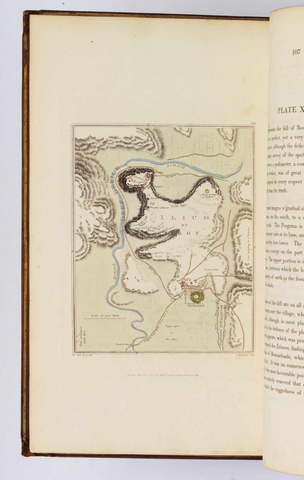
Contemporary calf, covers framed by blind cresting palmette roll and gilt rules, gilt palmette cornerpieces, neatly rebacked to style, raised bands, spine panels decorated with blind rolls, gilt titling, new endpapers, marbled edges. HAND COLORED THROUGHOUT, INCLUDING 12 AQUATINT VIGNETTE HEADPIECES (one of these uncolored) AND 43 ILLUSTRATIONS ON 28 PLATES (14 of these etchings, 29 aquatints, three folding) PLUS TWO ENGRAVED MAPS. Abbey Travel 399; Blackmer 660. ◆Leather worn away at corners, long, thin scratch on back cover, short tear to head of one plate (touching only frame and sky), three quires and one map a little foxed, occasional light offsetting to text leaves adjacent to plates, but still quite an excellent copy--the binding solid and not unattractive, and clean and fresh internally, WITH BRIGHT, PLEASING PLATES.
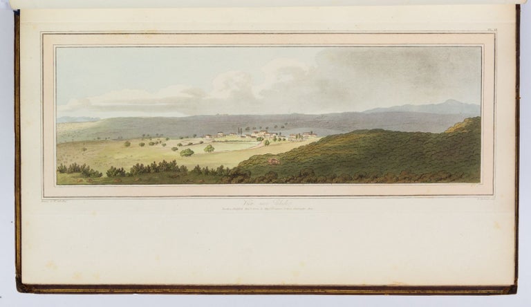
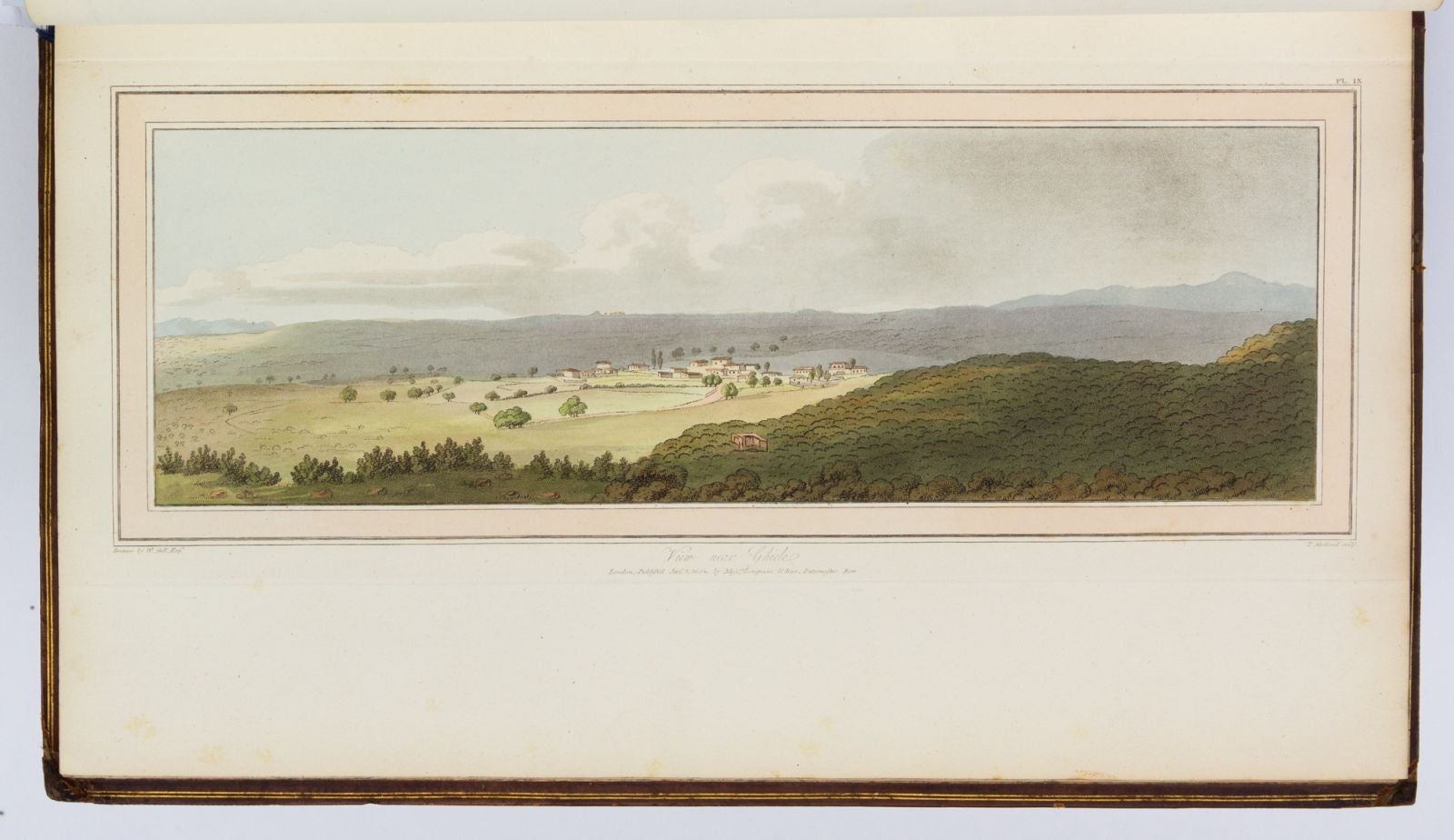
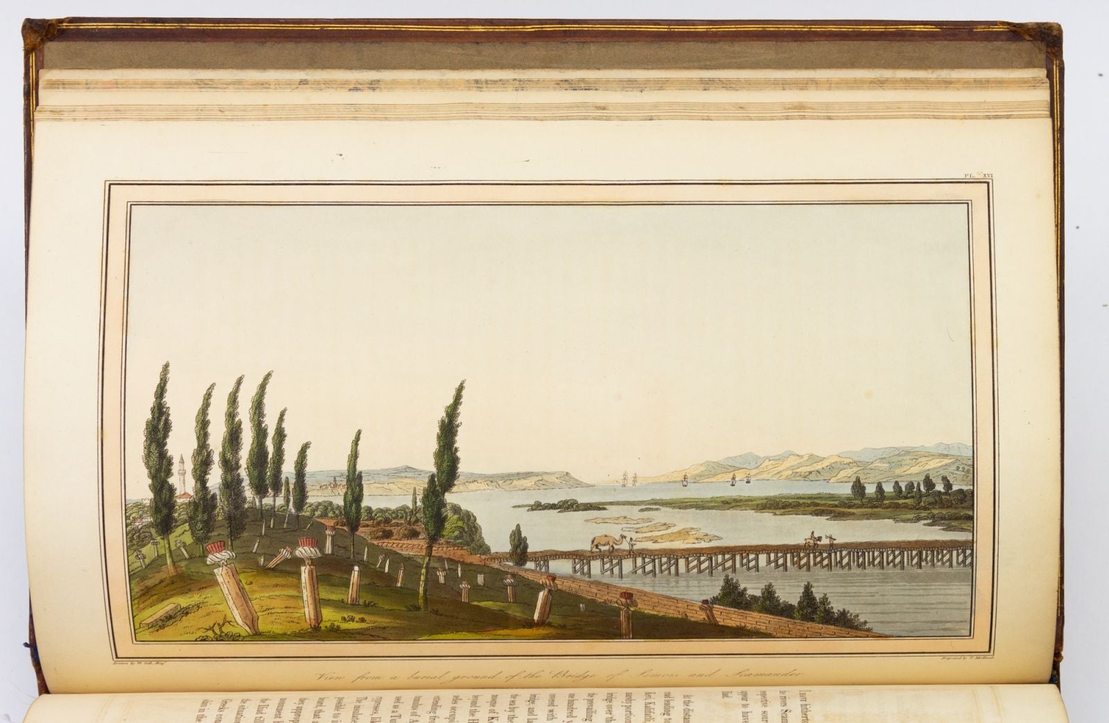
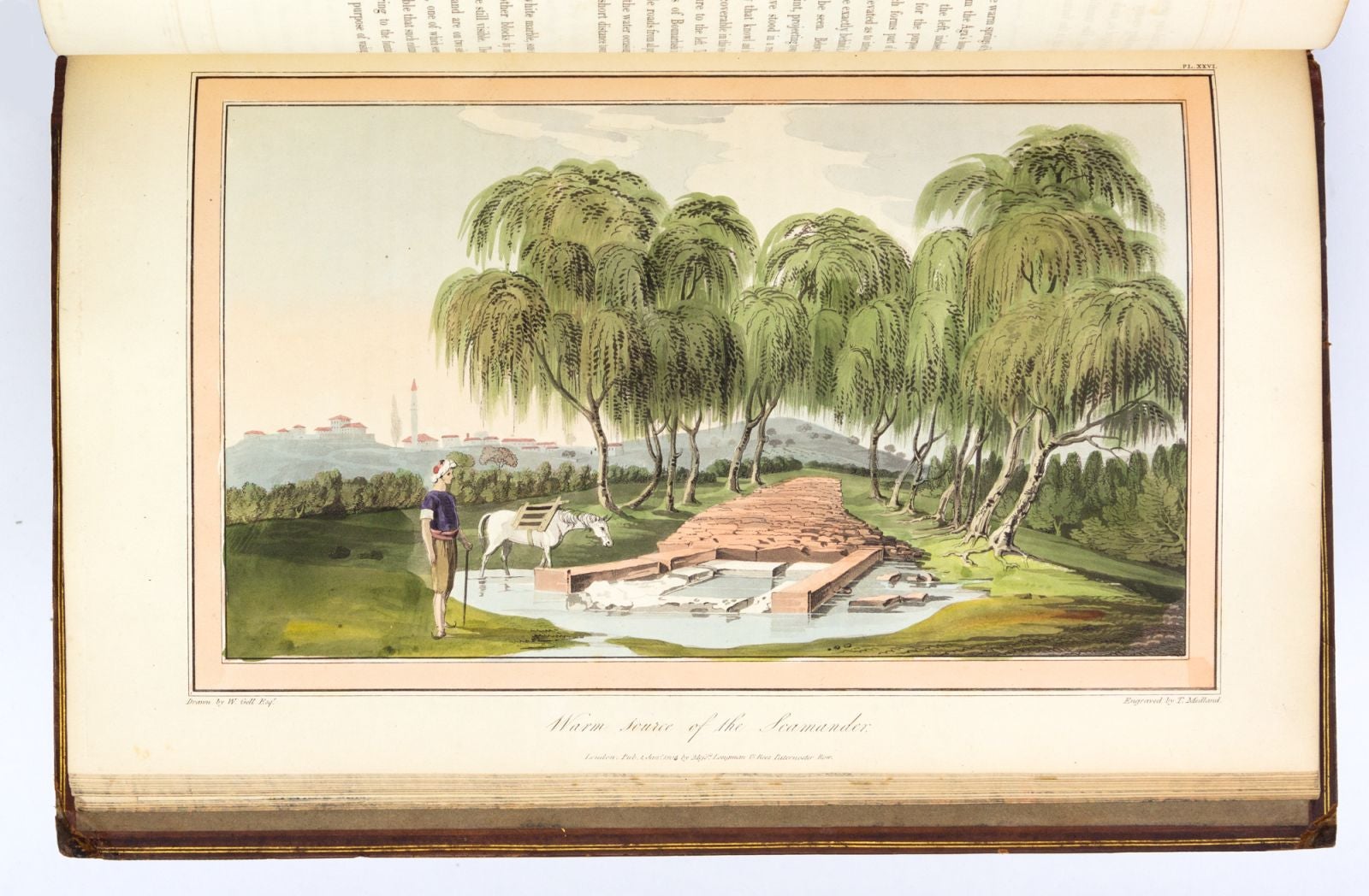
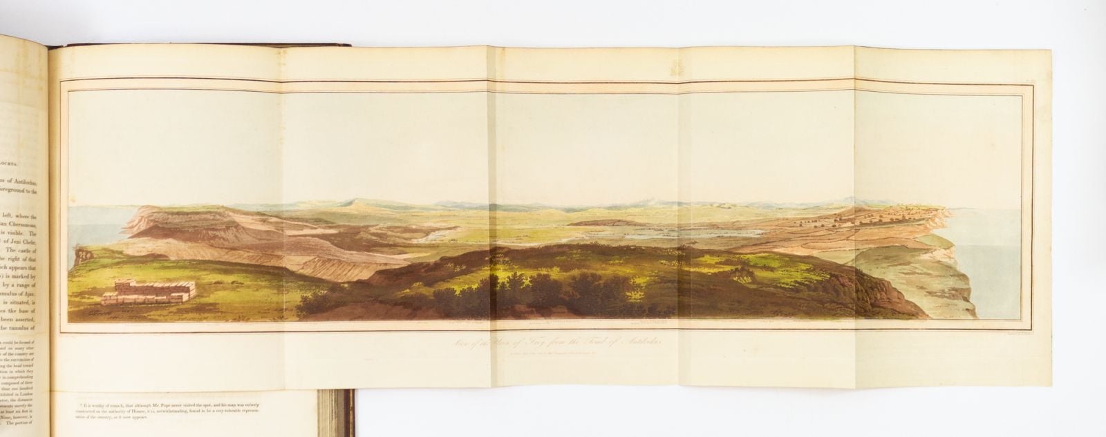
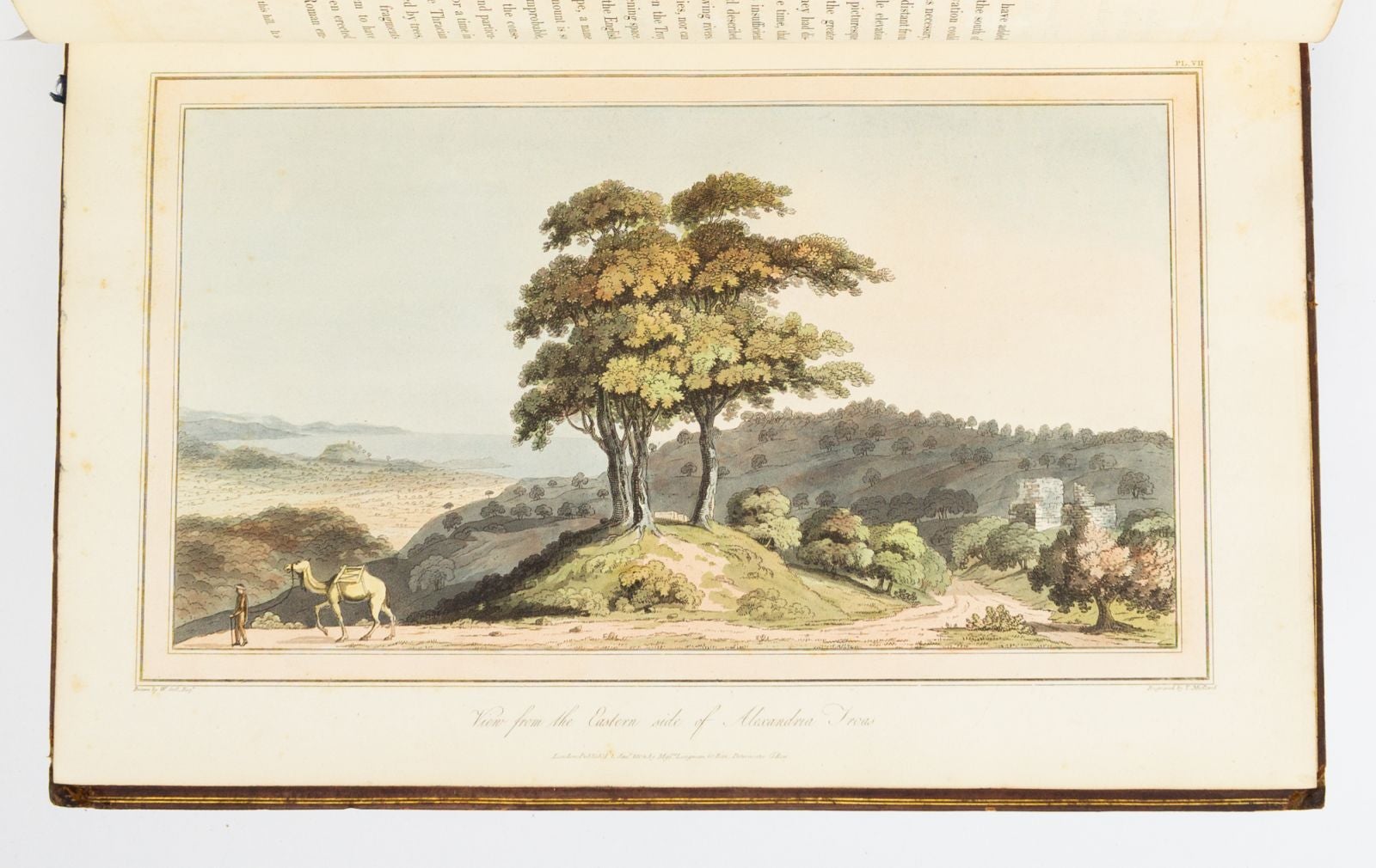
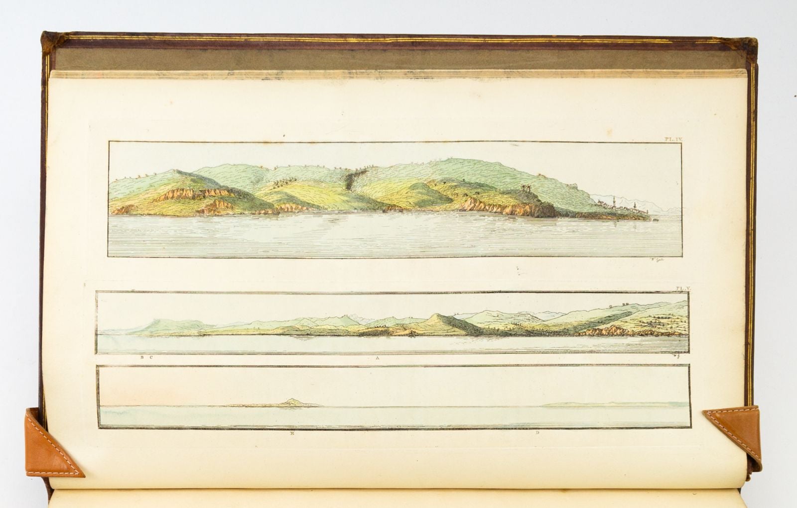
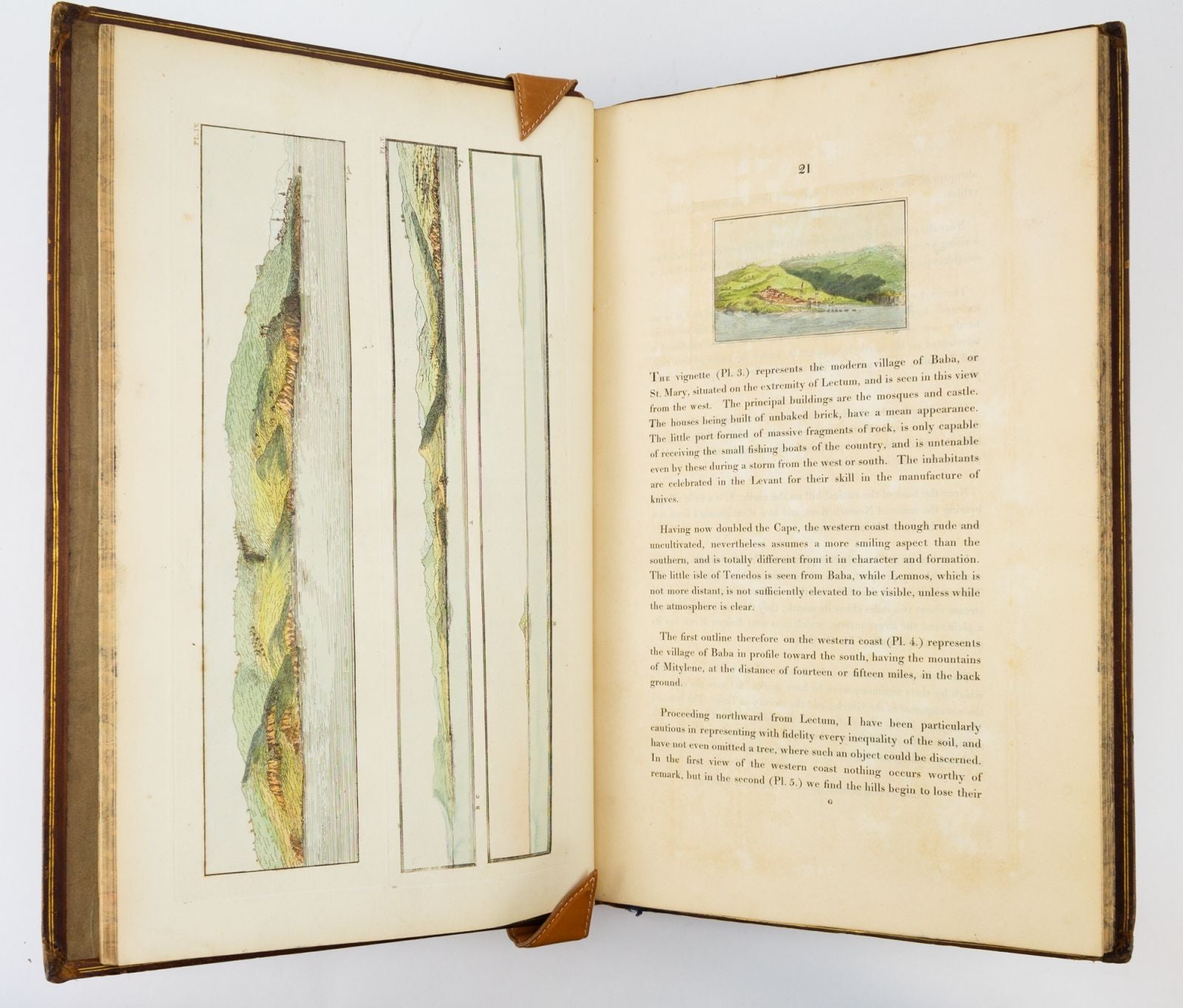
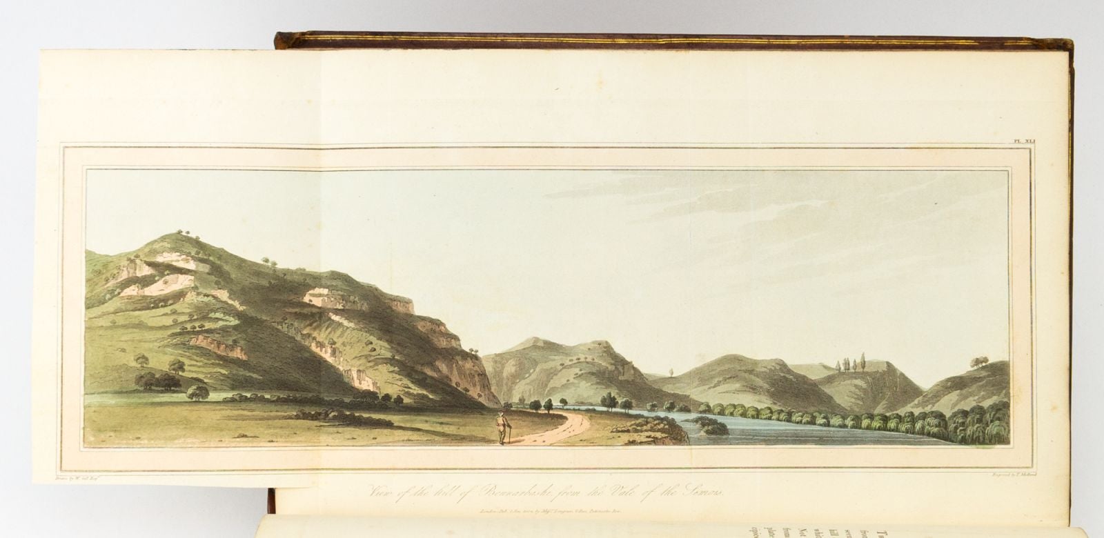
This impressive debut work by classical archaeologist William Gell has long been considered the most beautiful book on Troy. It elicited praise from no less a philhellene than Lord Byron, who Abbey notes included this couplet in "English Bards and Scotch Reviewers": "Of Dardan tours let dilettanti tell / I leave topography to classic Gell." Soon after receiving his B.A. in 1798 from Emmanuel College, Cambridge, Gell (1777-1836) travelled to the eastern Mediterranean, where he explored the Troad region in northwest Asia Minor, believed to be the location of the ancient city of Troy. He eventually settled on Burnabashi as the likely site of the Trojan War, and proceeded to produce the sketches and maps that populate this work. He employed the emerging technology of the camera lucida (which would be patented by English chemist William Hyde Wollaston in 1806) as a sketching aid; the device uses mirrors to superimpose the scene to be sketched on the drawing surface, consequently improving accuracy. The resulting views are more like panoramic photographs than the topographical engravings familiar from Merian and other earlier works. The views are broad and sweeping, often with mountains or sea in the distance, and perhaps a traveller, shepherd, or cranky camel in the foreground. According to DNB, "Gell represented the culmination of the literary topographical tradition. Written when Greece and even Italy were comparatively little known to English travellers and classical students, his works were for some time regarded as standard treatises, and much of the information they contain is still of value." (ST17496-006)
Price: $6,000.00